skip to main |
skip to sidebar

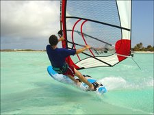
Josh in Bonaire 2007

Ben in PEI 2008

Barbara in Bonaire 2007

Caution Trespass 6' surfboard

Mad Cow
Plywood & Foam Kiteboard 180 x 60

Underground FLX 138 x 43

Rebuilt Ocean Rodeo Mako Wide
150 x 40

2012 Naish, Air Nalu,
Inflatable SUP, 11'-6" x 33" x 6"

2012 Slingshot Rally 14

Real Wind
Carbon Power Surf 260
85 liters, with thrusters
8" flexi top wave fin

Starboard Acid waveboard
94 liters
9" weed/wave fin
web225H.jpg)
Starboard Carve,
123 liters,
11.5" weed fin.

Real Hot, Power Wave sails
6.2, 5.7, 5.2, 4.2, 3.5
Nolimitz skinny masts
Chinook alum booms
Recent Comments
To view a comment or to leave your own:
Click on a recent comment above or
Click on a heading to a post, then scroll down.
Click on a recent comment above or
Click on a heading to a post, then scroll down.
Blogs
Links
Repairs
Wind
Waves
Associations
Kitesurfing Instruction
Windsurfing Instruction
Photography
Posts- by Location
- Allagash- Paddling
- Aunt Carrie's
- Backpacking
- Barnstable Harbor
- Bath
- Block Island
- Block Island- Andy's Way
- Block Island- Crescent Beach
- Boat Building
- Boating
- Bonaire
- Boston Harbor
- Boston Harbor outside Pleasure Bay
- Buzzards Bay
- Camp Cronin Fishing Area
- Chapin Beach
- Chappaquoit Beach/ Buzzards Bay
- Chappy
- Chatham- Scatteree Landing
- Chatham- Strong Island Landing
- Chatham- The Cut
- Coast Guard Beach
- Connecticut River
- Connecticut- Bluff Point
- Connecticut- Flat Hammock Island
- Connecticut- Stratford/Long Beach
- Corporation Beach
- Cranes Beach
- Crows Pasture
- Cuttyhunk
- Deep Hole/ Matunuck
- Delaware
- Dog Bar Breakwater
- Downwinders
- Duxbury- Bayside Kite Spot
- Duxbury- ocean side
- Duxbury- Powder Point Bridge
- Egg Island
- Egypt Beach- Scituate
- First Encounter Beach
- Fogland Point
- Good Harbor Beach
- Grinnell Beach
- Hampton Harbor
- Hardings Beach
- Hatch Beach
- Hatteras
- Head of the Meadow
- Hiking
- Horseneck Beach
- Hough's Point/ Boston Harbor
- Indian Lake/ Worcester
- Jamestown- Frigate St.
- Kalmus Beach
- Kennebec
- Lake Quanapowitt
- Long Beach- Gloucester
- Long Island NY
- Long Sands Beach/ Maine
- Maine- Casco Bay
- Martha's Vineyard- Cape Poge
- Martha's Vineyard- Katama Bay
- Maryland- Assateague Island
- Mayflower Beach
- Mill Creek Marsh
- Monomoy Island
- Moosehead Lake
- Nahant/ Dog Beach
- Nahant/ Long Beach
- Nahant/ Lynn
- Nantasket Beach
- Nantucket
- Narragansett Beach
- Nauset Beach
- Nauset Harbor
- Nauset Light Beach
- Ned's Point
- New Cut
- Newport/ First Beach
- Niles Beach
- Ninigret Pond
- Paddling
- Paine's Creek
- Pavillion Beach Ipswich
- PEI Canada
- Pleasure Bay/ Boston
- Plum Island
- Plum Island- Newburyport Harbor
- Plymouth Beach
- Plymouth/ Nelson St.
- Plymouth/ Saquish
- Popham Beach
- Portsmouth
- Pt. Judith- Georges Restaurant
- Rehobeth Bay
- Revere Beach
- Ridgevale Beach
- Salisbury State Park
- Salisbury/Newburyport
- Sand Spit
- Sandy Neck
- Scarborough Beach
- Seabrook Beach
- Skaket Beach
- South Cape Beach
- South Village Beach
- Squannacook River
- Stage Harbor
- Sunken Meadow Beach
- SUP
- Taylor's Lane
- Town Neck Beach
- Waquiot Bay
- Wellfleet
- West Dennis Beach
- West Island
- Wingaersheek Beach
- Winnipesaukee
- Winthrop Beach
- Winthrop- Yirrell Beach
- Wood Neck Beach
this is just a spacer
Wallet Pictures

Josh in Bonaire 2007

Ben in PEI 2008

Barbara in Bonaire 2007
Blog Archive
-
▼
2007
(68)
-
▼
June
(6)
- Kalmus, Windsurfed, WSW, 10-26, with Gerry, 5.2,6....
- Boston Harbor- Hough's Point, Windsurfed, NW, 10-2...
- Boston Harbor, Windsurfed, SW, 10-15, 6.2/Carve123
- West Dennis/ Kalmus, Landboarded, SW, 3-10 MPH, 5....
- Pleasure Bay, Windsurfed, NE, 20-30, a few others,...
- Plymouth Beach, No wind, No direction, No Wndsrfin...
-
▼
June
(6)
The Toys

Caution Trespass 6' surfboard

Mad Cow
Plywood & Foam Kiteboard 180 x 60

Underground FLX 138 x 43

Rebuilt Ocean Rodeo Mako Wide
150 x 40

2012 Naish, Air Nalu,
Inflatable SUP, 11'-6" x 33" x 6"

2012 Slingshot Rally 14

Real Wind
Carbon Power Surf 260
85 liters, with thrusters
8" flexi top wave fin

Starboard Acid waveboard
94 liters
9" weed/wave fin
web225H.jpg)
Starboard Carve,
123 liters,
11.5" weed fin.

Real Hot, Power Wave sails
6.2, 5.7, 5.2, 4.2, 3.5
Nolimitz skinny masts
Chinook alum booms
Wind Range of Kites & Sails
Kites
17 Blade Fat Lady (2012); 10-22.
14 Slingshot Rally (2012); 12-28.
10 Slingshot Rally (2012); 15-35.
17 Blade Fat Lady (2012); 10-22.
14 Slingshot Rally (2012); 12-28.
10 Slingshot Rally (2012); 15-35.
8 Slingshot Rally (2012); 15-37.
6 Slingshot Rally (2014); 25-45.
6 Slingshot Rally (2014); 25-45.
Sails
6.2; 15-25.
5.7; 17-27.
5.2; 20-28 perfect, 15-33 manageable.
4.2; 25-35, 20 to 40 manageable.
3.5; 30-40, 25 to 45 manageable.
6.2; 15-25.
5.7; 17-27.
5.2; 20-28 perfect, 15-33 manageable.
4.2; 25-35, 20 to 40 manageable.
3.5; 30-40, 25 to 45 manageable.
 Looking west, mid-tide, when I launched.


0 comments:
Post a Comment